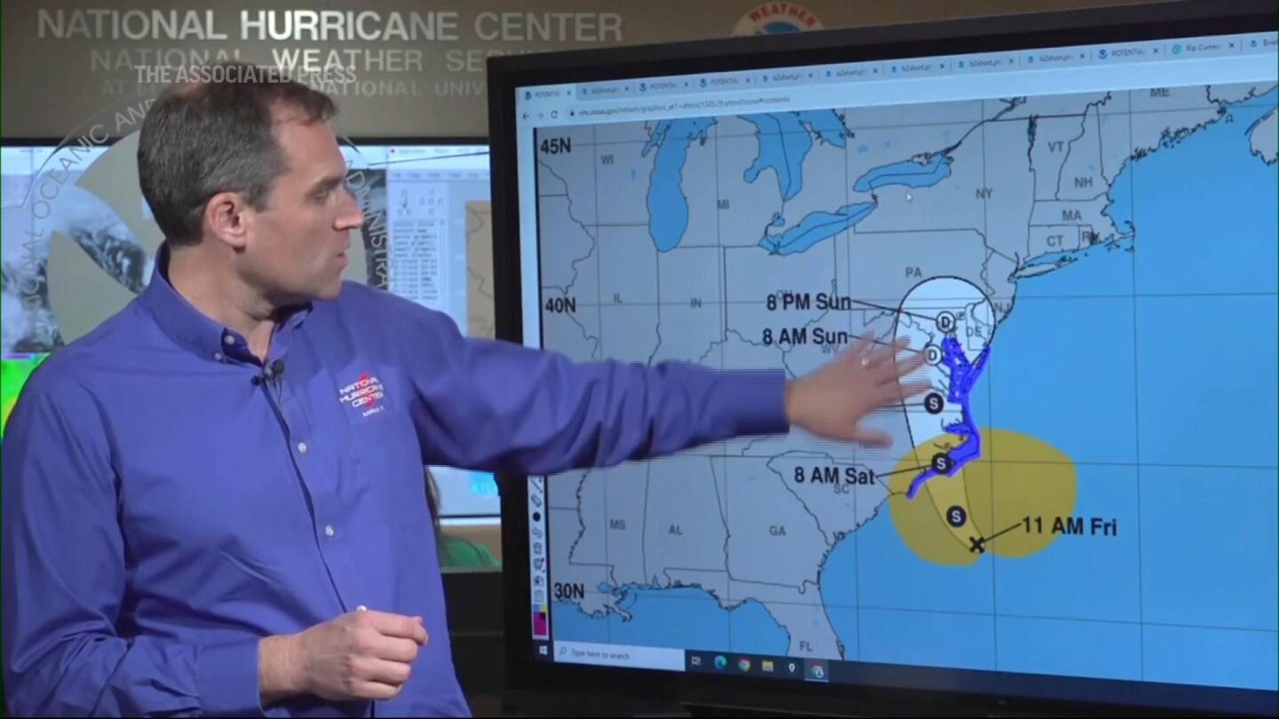
Annapolis, MD (AP) — Tropical Storm Ophelia gained strength Friday as it moved toward the North Carolina coast, cementing conditions with heavy rain and wind across the mid-Atlantic for the weekend.
Forecasters issued a tornado watch for parts of eastern North Carolina. The storm was expected to make landfall in North Carolina on Saturday morning and drop up to 7 inches (17.7 centimeters) of rain in parts of the state and southeastern Virginia.
The intensified weather system became a tropical storm in the afternoon and sustained overnight maximum sustained winds of 70 mph (113 kph), according to the U.S. National Hurricane Center.
The hurricane center said the storm was not expected to strengthen further before landfall and was forecast to weaken later.
Ophelia was about 70 miles (115 kilometers) south of Cape Lookout, North Carolina, and moving north-northwest at 12 mph (19 kph) just before 11 p.m., forecasters said.
Water levels are rising along parts of the North Carolina coast, and storm surge warnings are in effect for some areas. Waves of 3 to 5 feet (0.9 and 1.5 meters) are forecast for parts of the state, the hurricane center said.
The governors of North Carolina, Virginia and Maryland declared states of emergency. Some schools closed early and many weekend events were canceled as communities prepared for the storm’s arrival.
“We are expecting strong winds, heavy rain and high tides,” Maryland Governor Wes Moore said in an evening statement.
Nancy Shoemaker and her husband, Bob, carry sandbags to protect their waterfront home at Waterfront Park in Annapolis, Maryland.
Last October, water flooded their backyard, even washing away some sandbags.
“We’re hoping that won’t be the case this time,” Nancy Schumacher said. “If we have more wind and more waves, it will look like an ocean, so that’s a problem.”
A storm surge warning was in effect from Beaufort Inlet, North Carolina to Chincoteague, Virginia, and a tropical storm warning was issued from Cape Fear, North Carolina to Fenwick Island, Delaware.
Ophelia affected water taxis Friday in Annapolis, where driver Scott Bierman said service will end at 6 p.m. and will be closed Saturday.
“We will not operate when passengers are at risk and vessels are being damaged,” Bierman said.
In Washington, the Nationals baseball team postponed its Saturday game until Sunday.
Michael Brennan, director of the National Hurricane Center, said it’s not unusual for one or two tropical storms — or even hurricanes — to form on the East Coast each year.
“We’re in the height of hurricane season, and storms can form basically anywhere in the Atlantic basin,” Brennan said.
Scientists have said that cyclones can occur due to climate change Expanding their horizons Mid-latitude regions often produce storms similar to this month Hurricane Lee Universal standard. One The study simulated tropical cyclones Pre-industrial times, modern times and a future with high emissions. It found that hurricanes would develop near coastal areas including Boston, New York and Virginia, with a higher chance of developing along the Southeast coast.
North Carolina Governor Roy Cooper issued his state’s emergency declaration to help expedite preparations and provide a quick response.
“It’s difficult to predict a storm’s path, and we want to make sure farmers, first responders and utility crews have the tools they need to prepare for severe weather,” Cooper said.
The North Carolina Ferry System suspended service on all routes Friday until conditions improve, officials said.
An executive order from Virginia Governor Glenn Young also sought to facilitate response and recovery efforts.
“We want to ensure that all communities, especially those with the greatest expected impact, have the resources they need to respond and recover from the effects of this storm,” Youngin said.
The governor encouraged residents to prepare an emergency kit and follow the weather forecast carefully.
Meanwhile, Hurricane Nigel Downgraded to a post-tropical cyclone centered about 640 miles (1,030 kilometers) northwest of the Azores, with maximum sustained winds of 70 mph (110 kph). There were no associated coastal watches or warnings as the storm moved northeast at 37 mph (59 kph), the hurricane center said in its final update on the computer Friday morning.
___
Brumfield reported from Silver Spring, Maryland. AP Radio Correspondent Jackie Quinn in Washington and AP Correspondent Lisa Bauman in Washington State contributed.
___
Follow AP’s climate coverage: https://apnews.com/hub/climate-and-environment


/cloudfront-us-east-2.images.arcpublishing.com/reuters/6UDSHERHL5NPJOYI4IHCO542TY.jpg)
